
PIX4Dfield: Mapping Software for Aerial Crop Analysis and Digital Farming
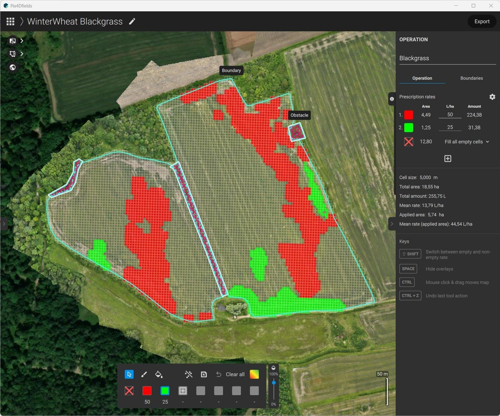
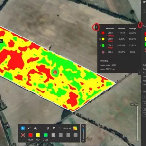
PIX4Dfields is a precision-agriculture mapping solution that converts drone and satellite imagery into crop-health maps, vegetation indices, zonation maps, and variable-rate or spot-spraying prescription maps.
About This Product
PIX4Dfields is an agriculture-focused mapping and analysis software designed to turn drone and satellite imagery into actionable crop information. It combines fast field-level mapping with tools for crop health analysis, vegetation indices, field zoning, weed detection, and prescription-map creation. The software can process imagery directly on a computer, allowing agricultural teams to generate maps and analyze fields even when working without an internet connection.
Key Features
- Fast drone and satellite image processing
- Offline, on-device mapping
- Unlimited hectare mapping
- RGB and multispectral image processing
- Vegetation index generation such as NDVI
- Crop-health analysis
- AI-assisted weed detection
- Field boundary and obstacle mapping
- Crop scouting tools
- Custom field zonation
- Variable-rate application maps
- Spot-spraying prescription maps
- Direct export to compatible agricultural machinery
- Digital Surface Model generation
- Field measurements and annotations
- PDF reports and project documentation
- PIX4Dcloud sharing
- Satellite imagery integration
- Field Insights using AI-based crop analysis
Main Outputs
- Orthomosaic: GeoTIFF, high-resolution JPG
- Vegetation Index Maps: GeoTIFF, high-resolution JPG
- Zonation Maps: Shapefile, KML, GeoJSON, GeoTIFF
- Prescription Maps: Shapefile, KML, GeoJSON, ISOXML
- Digital Surface Model: GeoTIFF
- Field Boundaries: Shapefile, KML, GeoJSON
- Obstacles: Shapefile, KML, GeoJSON
- Annotations: Shapefile, KML, GeoJSON
- PDF Reports
- Field Insights Reports
- Snapshots: JPEG/PNG
- XYZ Data: CSV
Supported Inputs
- JPEG/JPG drone imagery
- TIFF imagery
- RGB imagery
- Multispectral imagery
- Supported thermal imagery
- GeoTIFF maps
- Field boundaries and obstacles
- KML, GeoJSON and Shapefile data
- Sentinel-2 satellite imagery
- High-resolution satellite imagery
Applications
- Precision agriculture
- Crop scouting
- Crop-health monitoring
- Variable-rate fertilization
- Spot spraying
- Weed detection
- Irrigation analysis
- Crop protection
- Field trial management
- Agricultural research
- Crop insurance documentation
- Digital farming
- Agricultural drone operations
Technical Information
- Software Type: Agriculture mapping and crop-analysis software
- Platform: Windows & macOS
- Processing: Local / on-device
- Mapping: 2D orthomosaic and agricultural analysis
- Imagery: Drone and satellite
- Camera Support: RGB and multispectral; selected thermal cameras
- Vegetation Indices: Supported
- AI Detection: Weeds, field boundaries and obstacles
- Prescription Maps: Variable-rate and spot spraying
- Offline Processing: Supported
- Cloud Sharing: PIX4Dcloud
- Machinery Export: Supported for compatible tractors, spray drones and field sprayers
You must be logged in to post a review.
Related products
5 in stock
Reviews
There are no reviews yet.