Sale

")
")
")
")
")
")

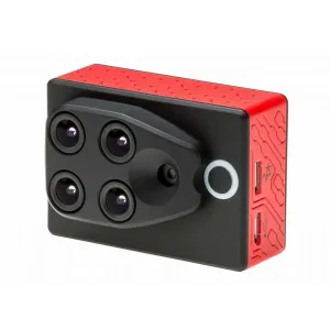
RedEdge-P Dual Multispectral Sensor Available in India on GadgetsDeal
Original price was: ₹1,700,000.00.₹1,670,000.00Current price is: ₹1,670,000.00.
- 10 Multispectral Bands – High-resolution imaging for detailed analysis
- Dual Sensor System – RedEdge-P and RedEdge-P Blue for enhanced data collection
- Satellite-Comparable Data – Matches Landsat & Sentinel with better resolution
- Coastal Blue Band – Ideal for water vegetation and shallow water monitoring
- Pan-Sharpening Technology – 2 cm spatial resolution per pixel
- Global Shutter – Distortion-free images across all 10 bands
- Fast Capture Rate – Up to 3 raw DNG images per second
- Radiometric Calibration – Ensures accuracy in varying light conditions
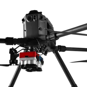
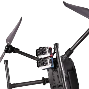
- DJI Matrice 300 Compatible – Works with leading drones & software
- Machine Learning & AI Ready – Supports crop counting and vegetation insights
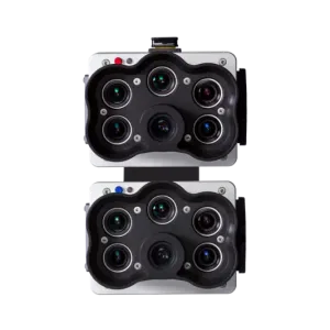
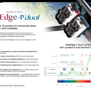
MicaSense Series – RedEdge-P Dual
Available in India on GadgetsDeal
Two sensors. 10 bands. Enhanced data comparison with satellites.
A high-resolution multispectral and RGB composite drone sensor designed for plant classification, weed identification, environmental research, and vegetation analysis of water bodies. The dual solution features the RedEdge-P and the new RedEdge-P Blue cameras.
Benefits:
- Obtain imagery comparable to Landsat and Sentinel satellite data at an enhanced resolution.
- Monitor shallow water environments with the coastal blue band.
- Perform detailed analysis on chlorophyll efficiency and identify weeds.
- Conduct reliable time-series analysis even in varying light conditions.
- Utilize machine learning and AI applications such as early-stage crop counting.
- Generate insights invisible to the naked eye with multiple outputs and indices such as RGB, NDVI, NDRE, OSAVI, NIT, CIR, DSM.
- Compatible with DJI Matrice 300 and a wide range of post-processing and flight planning software.
- Made in the USA.
MicaSense Sanee – RedEdge-P Dual
Specialized for Vegetation Analysis of Water Bodies
- Conduct surveys over water for chlorophyll efficiency examination, vegetation analysis, and identification of algae or floating, submerged, and emergent plants.
- Perform coastal and near-shore mapping for water resources management, tidal zones, swamps, and glacier monitoring.
- Enable habitat monitoring, protection, and restoration through biodiversity inspections, reef surveys, and analysis of inaccessible shallow waters.
- Improve vegetation health management by identifying and counting plants, trees, invasive species, and weeds.
Key Features:
- 10 multispectral bands at 1.6 MP each.
- Pan-sharpening technology for 2 cm / 0.8 in per pixel spatial resolution.
- Coastal blue band for water vegetation analysis and weed identification.
- Double radiometric calibration with light sensor and calibration reflectance panel.
- Global shutter on all 10 lenses for distortion-free image capture.
- Narrow bands for enhanced data accuracy.
- Fast capture rate of 3 raw DNG images per second.
- Synchronized capture of all 10 bands with automatic triggering and geotagging.
Specifications:
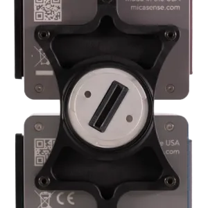
- Weight: 745 g / 20.2 oz (includes two sensors, mounting hardware, DLS2, and cable)
- Dimensions: 13.2 cm x 8.8 cm x 2.67 cm / 5.1 in x 3.1 in x 3.5 in
- Spectral Bands: Coastal blue 444(28), Blue 475(32), Green 531(14), Green 560(27), Red 650(16), Red 688(14), Red Edge 705(10), Red Edge 717(12), Near-IR 740(18), Near-IR 842(57)
- RGB Output: 5.1 MP (global shutter, aligned with all bands)
- Sensor Resolution: 1456 x 1088 (1.6 MP per multispectral band) / 2464 x 2056 (51 MP panchromatic band)
- Ground Sample Distance: 7.7 cm / 3 in per pixel (multispectral band) at 120 m / 400 ft AGL
- Field of View: 50° HFOV x 38° VFOV (multispectral), 44° HFOV x 38° VFOV (panchromatic)
- Capture Rate: Up to 3 images per second (raw DNG)
- Storage: CFexpress card
- Interfaces: USB 2.0, Serial, 10/100/1000 Ethernet, configurable GPIO
- Power Input: 7.0V – 25.2V, 11W standby, 14W average, 20W peak
- Operating Temperature: 0-40°C without airflow / 0-50°C with airflow
- IP Rating: IP4X
You must be logged in to post a review.


Related products
Out of stock
Available on backorder
1 in stock (can be backordered)
Out of stock
Sale
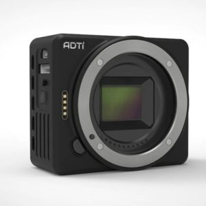
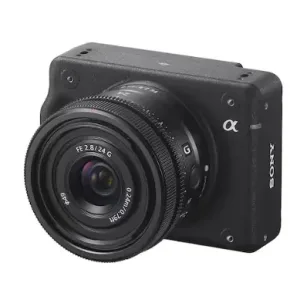
Drone Mapping Camera – ADTi Sony Alpha for GIS Surveying in India
Original price was: ₹130,000.00.₹120,000.00Current price is: ₹120,000.00. Add to cart
Available on backorder
5 in stock
Reviews
There are no reviews yet.