
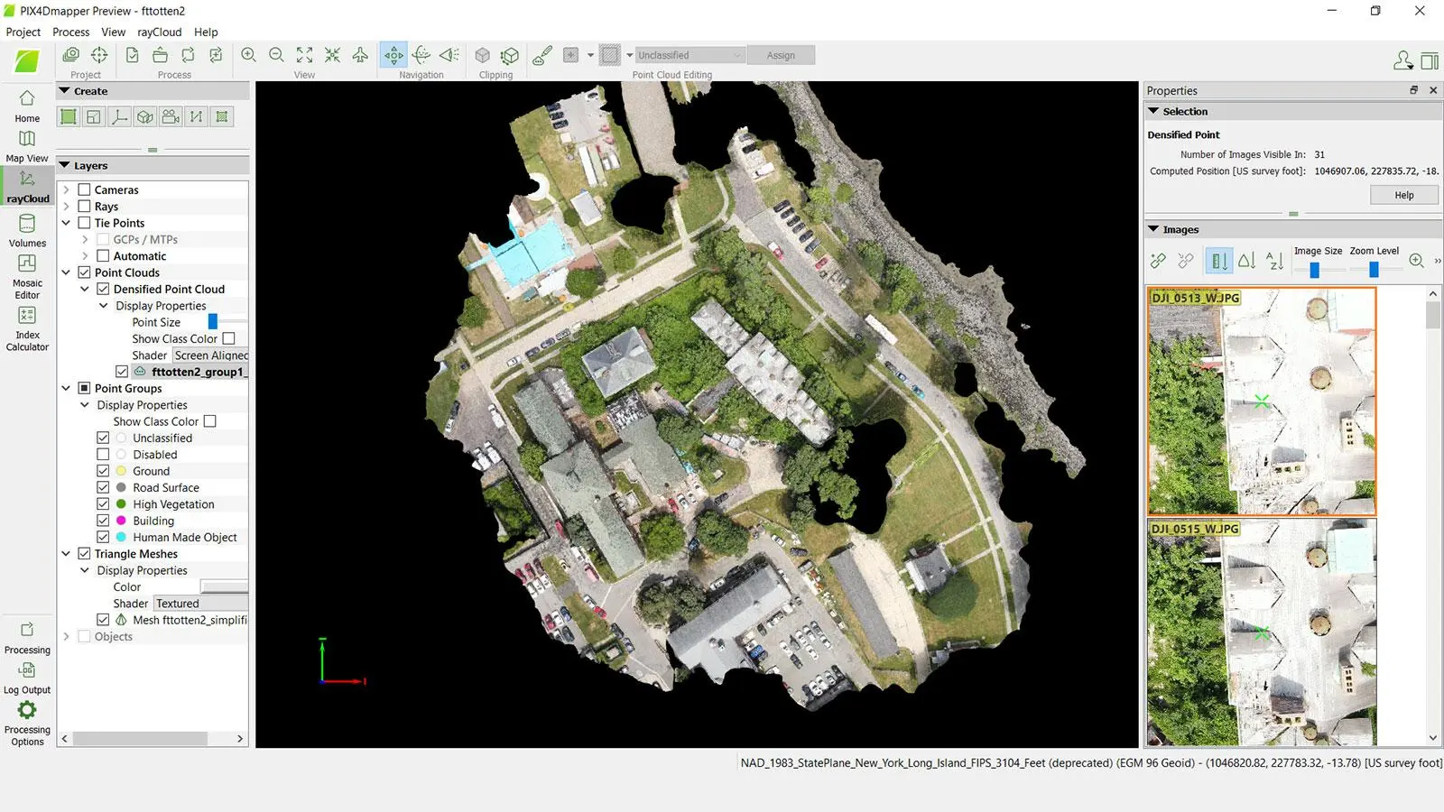
PIX4Dmapper Educational License
PIX4Dmapper Educational License provides academic access to professional drone photogrammetry software for creating georeferenced orthomosaics, point clouds, 3D models and mapping outputs from aerial imagery.
About This Product
PIX4Dmapper Educational License is an academic version of professional photogrammetry software designed for students, professors and educational institutions. It allows users to process aerial images captured by drones and convert them into accurate geospatial outputs for learning, teaching, research and practical mapping projects.
The software can transform overlapping images into orthomosaics, point clouds, 3D models and other mapping products. It provides an environment where students and researchers can learn the complete photogrammetry workflow, from image processing through quality assessment and final mapping outputs.
Features
- Designed for students, professors and educational institutions
- Professional photogrammetry processing
- Drone image processing
- Generation of georeferenced orthomosaics
- Dense point-cloud generation
- 3D textured model creation
- Digital surface and terrain model generation
- Image and project quality assessment
- Ground control point (GCP) support
- Coordinate reference system support
- Measurement and mapping tools
- Unlimited desktop processing
- High-resolution output generation
- Floating license system
- Support and software upgrades included
- Access to educational course material
- Suitable for classroom teaching and academic research
License Information
| Specification | Details |
|---|---|
| Brand | PIX4D |
| Product | PIX4Dmapper Educational License |
| Software Type | Desktop Photogrammetry Software |
| License Type | Educational / Academic |
| License Model | Floating License |
| Usage | Academic / Educational |
| Processing | Unlimited Desktop Processing |
| Output | High-Resolution Outputs |
| Support | Included |
| Upgrades | Included |
| Course Material | Included |
| Training Discount | 50% discount on training products |
| Eligibility | Recognized educational institutions/users |
| Educational Email | Official educational institution email required |
| Proof of Affiliation | May be requested |
| Internet | Required for activation/login |
Educational License Types
PIX4D’s education program also provides different structures depending on the user:
- Professor: Single-seat educational license
- Classroom: Up to 25 devices/seats for classroom teaching
- Student: Short-term single-seat license for student learning
These educational licenses are intended for recognized educational institutions and require verification of educational affiliation.
Applications
- Drone mapping education
- Photogrammetry training
- Surveying and GIS education
- University research
- 3D modelling projects
- Topographic mapping studies
- Remote-sensing education
- UAV mapping courses
- Orthomosaic generation
- Point-cloud and 3D reconstruction projects
You must be logged in to post a review.


Reviews
There are no reviews yet.